As part of a wider research project combining excavation, radiocarbon dating and digital recording, photogrammetry and surface analysis revealed the true scale and complexity of the rock art at Hendraburnick ‘Quoit’ in north Cornwall.
The subject
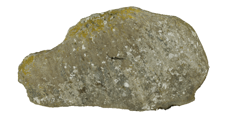
Hendraburnick ‘Quoit’ sits unremarkably in a pasture field near Camelford in north Cornwall, a few kilometres west of Bodmin Moor. It is not actually a quoit at all: the main stone is a large axe-shaped greenstone slab, weighing around 16 tonnes, propped on a low platform of slates and encircled by waterworn quartz blocks. A second elongated greenstone lies to the east, almost certainly a fallen standing stone. Prehistorians had largely passed the site by, and earlier assessments had even doubted whether it was genuinely man-made. The cup-marks noticed on the main stone were real enough, but nobody had established how many there were, how they related to one another, or what they might reveal about the site’s history and significance.
The challenge
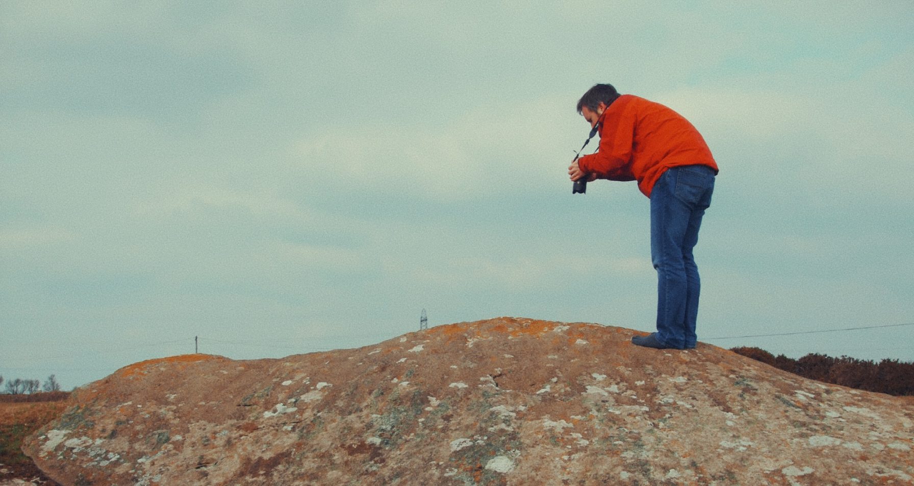
Rock art is notoriously difficult to read and to record. Much of it survives as shallow surface working — cups, grooves and lines worn down by millennia of weather — that is largely invisible except under raking light. The main stone at Hendraburnick is over five metres long and faces south-east, propped at an angle, which means its carved face cannot be photographed from a single vantage point. Field observation had already suggested that the art was most visible in low afternoon sunlight or by moonlight, making conventional recording impractical and incomplete. Without a systematic digital approach, the true extent of the decoration would remain a matter of guesswork.
What I did
In 2016, I was brought into the project by the late Dr Andy M. Jones of the Cornwall Archaeological Unit, whose excavations at the site had already produced radiocarbon dates and a significant finds assemblage. My role was to record and analyse the carved surfaces in detail. The project was funded by the Cornwall Archaeological Society.
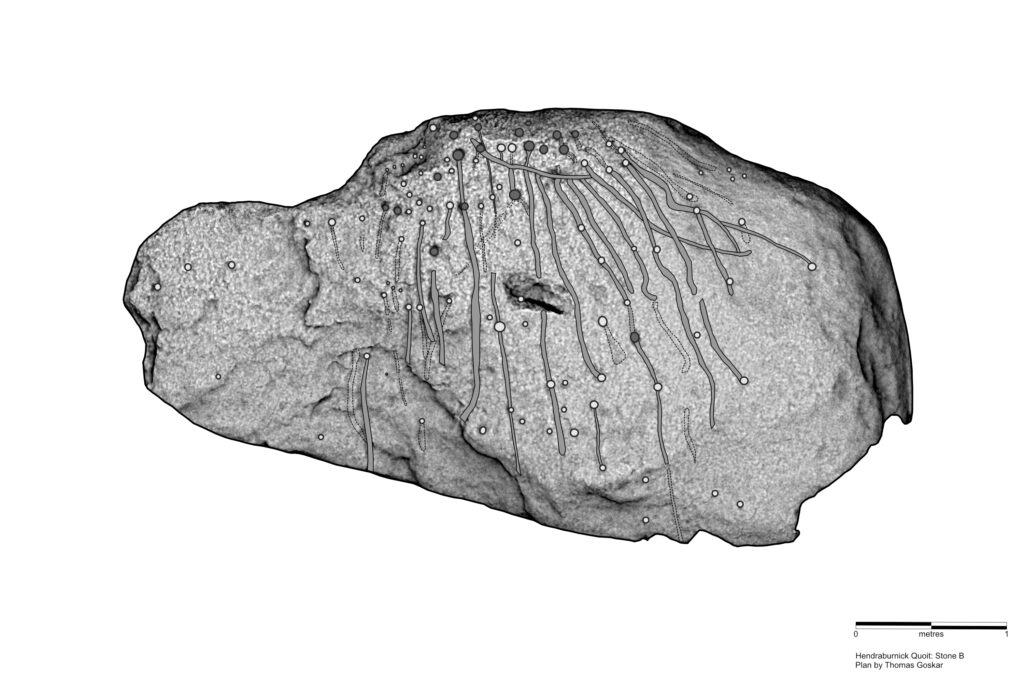
Careful planning and several hundred overlapping photographs — including, where necessary, working directly on the stone surface to achieve the coverage needed — produced a point cloud of 75 million vertices, refined to a 35-million-vertex high-resolution mesh of the main stone.
The analytical work that followed was painstaking. I applied every surface enhancement technique available to me: hill-shading from multiple directions, depth mapping, ambient occlusion, trend surface analysis, radiance shading and virtual RTI. Each method reveals different qualities of a surface, and using them in combination is essential when working with shallow or ambiguous features where any single technique might mislead. Potential cup-marks and linear features were traced in a layer-based drawing package, with every candidate cross-checked against several types of filtered imagery, the 3D model and the original photographs before being accepted. Nothing was included on the strength of one method alone.
The 3D mesh also allowed me to calculate the volume of the main stone by reconstructing concealed areas of its underside. Using the resulting approximate volume of 6.326 cubic metres and comparative greenstone density values, I estimated its weight at about 16.6 tonnes.
What became clearer
The analysis identified 105 cup-marks and 47 possible grooved lines radiating and connecting across the stone’s surface. The deeper cups are concentrated along the upper edge; shallower ones spread more widely, and the lines appear to flow downslope — suggesting they were carved after the stone was already in position rather than before it was moved. Multiple phases of carving are visible, with some marks clearly superimposed on others, pointing to a process of repeated inscription over centuries rather than a single planned design.
Together with the excavation evidence, the total number of deliberately made features confirmed the propped stone at Hendraburnick as the most highly decorated example of rock art in southern Britain, with comparanda only in northern England and Ireland.
Why it mattered
The digital record gave the wider project something it could not otherwise have had: a rigorous, verifiable account of the art’s full extent. Combined with the radiocarbon dating placing the stone’s construction in the Late Neolithic, around 2571–2350 cal BC, the surface analysis helped confirm that the carving was an evolving, cumulative process — not a finished monument but a repeatedly revisited one, kept alive and meaningful across generations. The research was published in Time & Mind: The Journal of Archaeology, Consciousness and Culture (Jones & Goskar, 2017) and attracted national press coverage. It stands as a good example of what careful digital recording can contribute to a research excavation: not a separate strand of work, but an integral part of how the site was understood.
Collaborators: The late Dr Andy M. Jones, Cornwall Archaeological Unit
Funder: Cornwall Archaeological Society
Publication: Jones, A.M. & Goskar, T. (2017), Time & Mind, DOI: 10.1080/1751696X.2017.1341241
3D model: Available on Sketchfab (reduced resolution)
If you have a rock art site, carved stone or decorated monument that needs rigorous digital recording and analysis, get in touch.